


I hope this guide inspires you to do the beautiful Annapurna Base camp trek (also known as the Annapurna Sanctuary trek or simply ABC ). We decided to trek up to the Annapurna Base Camp, in Western Nepal in October when the skies are clear and the weather is warm. This trek is also called the Annapurna Sanctuary trek. It takes you to the heart, the valley of the 8000 meter mountains. And the perfect time to there is after the monsoons and before the onset of Winter, so the skies are very clear while being warm enough and before snow and ice makes it treacherous to trek near the base camps. But as a traveler I also dread this time because of the crowds of tourists wh all also want to enjoy the perfect weather just like I do. But we decided to take the risk, as clear weather and scenery was worth the human distractions.
Day 1: Kathmandu (1300m) to Pokhara (850m) to Birenthanthi
The long distance public transportation in Nepal is notorious for being un-timely, crowded, dangerously driven, and full of unwelcome surprises on the road. I suggest you take the half an hour flight to Pokhara if you can afford it. As we had planned this part of the trip at the last moment, we had no choice but to take a bus. We hopped on to a small “micro-bus”, better known as ‘Toyota Hiace” vans to the rest of the world. They cramped as many they could for Rs 500 each and off we went to Naya pul, the gateway to the Annapurna mountains. Naya Pul means New Bridge in English. What an irony, that we saw no bridges at Naya Pul village. We reached Naya Pul just after dark. We quickly set out for a short half an hour walk to the village of Birenthanti, where we rested for the day. The lodges there were packed, at least the famous ones, but we found one that was quieter and happy to accommodate us. Tomorrow would be a tough day as we hoped to cover what would normally take 1.5 or 2 days within a day as we were behind schedule.
Day 2. Birethanti (1520m) to Hile to Tikhedhunga to Ulleri 1960m to Ghorepani 2850m
Starting early is a good routine while trekking in the himalayas. We woke up around 6:30 in the morning. We stuffed ourselves with local “gurung” bread, a fried bread that some also call Tibetian bread. While most preferred jam and honey with it, I loved plastering ketchup all over it. I recommend this combination!
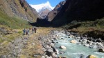
Birenthanti to Hile was pleasant walk besides rice paddy fields along a lovely river. As we crossed Hile we start coming across the dreaded stone steps going up and down instead of the smooth climb so far. Soon we reached Tikhedhunga, the base of what is infamously called the vertical steps of Ulleri. From here it would be nearly 4,000 stone steps up to Ghorepani! To explain better, it took us two hours of vertical climbing of stone stairways until we finally reached the village of Ulleri. I should have practised up and down the stairs back home for a few weeks. It would have been totally worth it. This climb exhausts you mentally as physically. It is best tried early in the morning before the mid day sun makes your climb ttorturous
Around noon, we stopped for lunch at the Ulleri village and rested for about an hour and half. From Ulleri it was comparatively easier but still uphill. Next stop was Banthanti. And then Ghorepani was at 2850 meters up.
Just before dusk, we reached Ghorepani and stayed at the very first lodge we saw. We were in no mood to choose the hotels with the best views. We would get a better view tomorrow morning from Poon hill anyway. Quickly I took out the muscle relaxants, rubbed in all over my legs and shoulders, popped in a pain killer, Ibuprofen, to preempt any pain and stiffness my legs would go through the night and tomorrow.
The night was rather annoying because of a few young guests who thought getting drunk and shouting in their rooms was a great way to spend the night at Ghorepani. Apparently they must have forgotten that they need to wake up at 4:30 am in the dark and climb 400 meters (an hour uphill) to get to Poon hill to see the sun-rise ?
If you have a choice it is always best to choose a corner room with a thicker wall. Most of these lodges in this region only use a thin plywood to divide rooms.
Day 3: Ghorepani 2850m to Poohill 3150m (and back) to Deurali to Taada-paani to Chuile
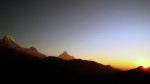
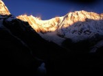
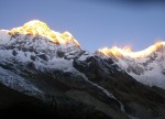
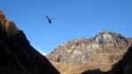
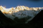
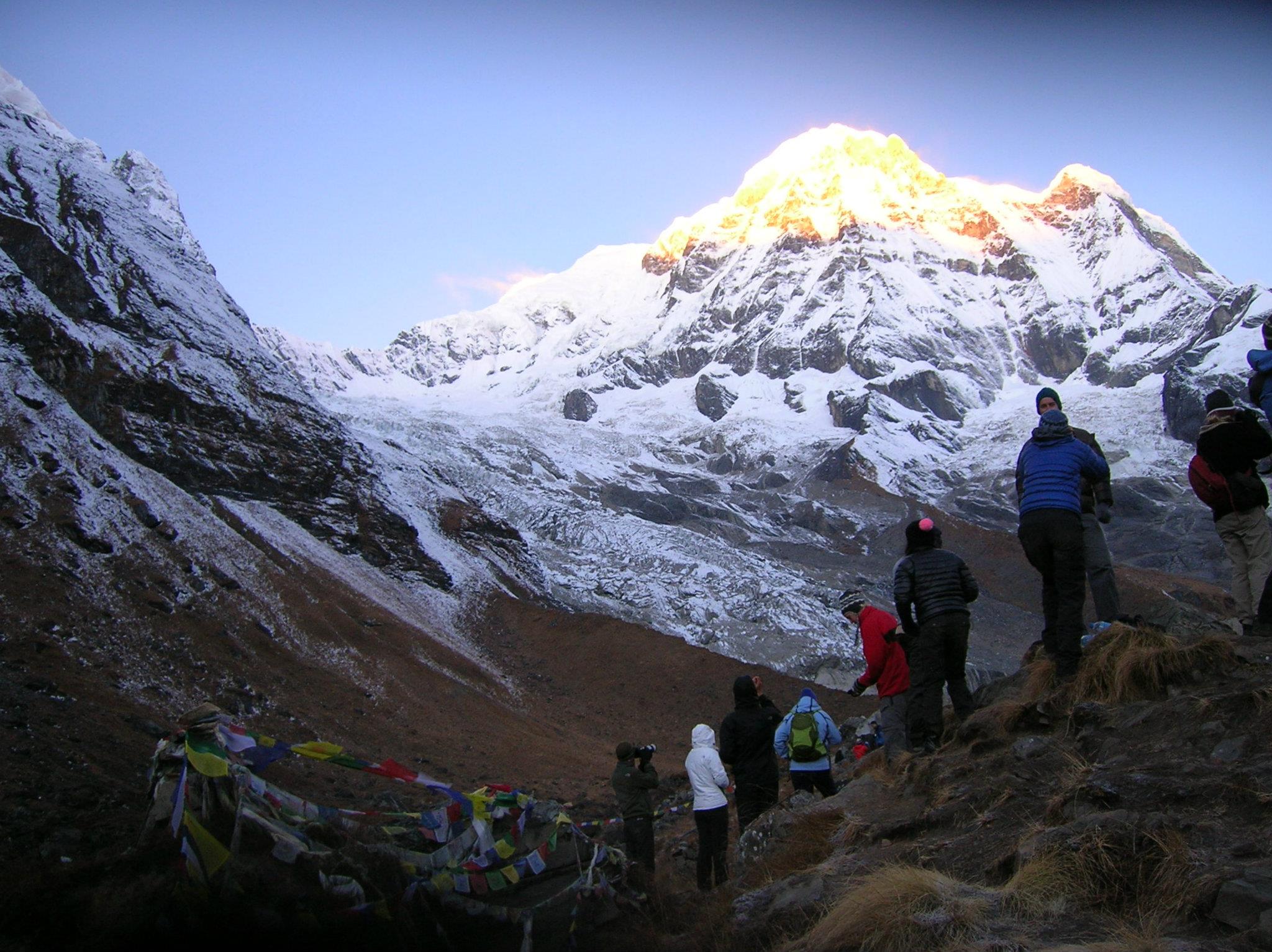
Another tough day! Woke up at 4:30 in the morning and started walking pitch dark to cover straight up 400 meters. My legs were soon cursing me again. As we moved up, we realized we were part of this enormous troupe of united nations of people from all corners, who had come to watch the famous sun rise on the Annapurna and Dhaulagiri mountains. When we finally reached the top, I was shocked to find a crowd there. There must be around 300 to 400 camera equipped faces of every color and shapes. It was hard to find a sweet spot here, to take a human free photo of the mighty mountains.
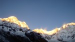
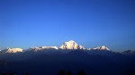
We all slowly waited for the sun to rise. Soon the colors of the sky start changing into multi shades of orange as slowly the sun rays hit upon the tops of the towering mountains, like streaks of gold pinned on the white tops. Even the Fish tailed Machhapuchhare mountain looks different from how we see typically from Pokhara.
As we watched the colors change on all around the mountains from the east to the west of us, all else was forgotten.

After a quick tea at the top, we walked back down to Ghorepani to have our breakfast. It’s weird that in this area, every egg dish in the menu would be made by putting 2 eggs in it, whether it is omelet or poached or… I guess one egg is never enough for a trekker!
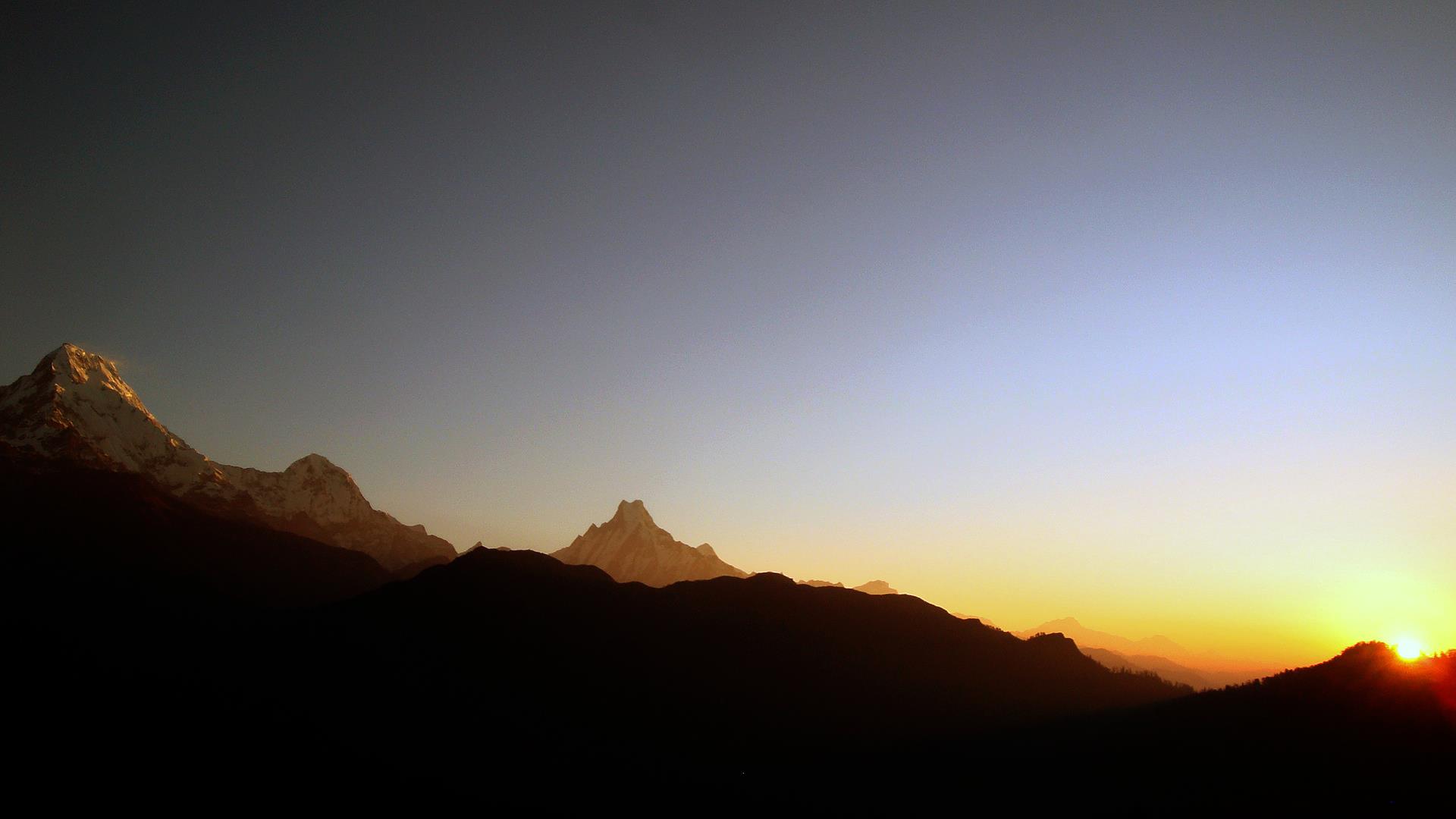
After breakfast at around nine, we started off again climbing on the other side of Ghorepani into Deurali where we could see just as majestic views of the whole Annapurna and Dhaulagiri ranges. As we reached Deurali, we became aware of how high we were, when we saw planes flying from Mustang to Pokhara, actually below us ! Everyone who saw that had a mischievous grin of pride!
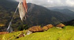
From Deurali it was all down hill until all the way to Ban Thaati. Then we climbed slightly to reach Taadapani where most travelers called it a day. But we decided to go a little further off to a place called “Chuile”. Chuile is 45 minutes straight down-hill from Taadapani and there is only one good hotel here, Gurjung Lodge which has a fantastic open garden and a great view of the Machha-puchhare (Fish-Tailed) mountain.
Day 4: Chuile (2400m) to Gurjung to Chomrung (2030 m) to Sinuwa (2350m)
We woke up to a fantastic view of the Fish tail Mountain and the Annapurna South (7200m). It was an agonizingly steep downhill walk into a ravine called “phedi” and then another steep climb up to arrive at Gurjung. After 4 hours, we reached into a big Gurung village ‘Chomrung’ which had all the excesses of civilization like washing machines, bakeries, chocolate cakes, attached toilets, among other civilized excesses 😛 This village must have as many hotels as Ghorepani and is the gateway to the Annapurna Base Camp. We had lunch there and we decided to push to Sinuwa, to gain a day in our trek. We had heard many stories of not finding a room to sleep in due to the over crowding of tourists, we reserved a room before we left Chomrung. My tired legs took me nearly three hours as this part involved going steep down stone stairs into the ravine many hundred meters down and then climb half a kilometer up to get to Sinuwa. I felt I had made a bad decision by making this extra effort. Nonetheless we reached Sinuwa just before dark. We stayed ‘Hilltop Lodge’ there. It seems all 3 lodges here looked the same. So I guess it didn’t matter, which one we stayed at.

Day 5: Sinuwa to Bamboo to Dovhan to Himalaya (2900m) to Deurali (3200m)
Another long day ! The day started very gloomy with rainy drizzle pouring over early – there was some snowfall in the surrounding hilltop during the night. To top this misery, I had neglected to bring my rain jacket. Fortunately the shops sold plastic sheets (that could more or less cover us and our bags). we headed out at 9 in the morning. After a gradual climb and a steep descent , we reached Bamboo in about two hours, True to its name, this place is surrounded by bamboo trees which would stretch all the way to the next settlement called “Dovhan”. Bamboo and Dovhan are bottleneck places in the ABC trek, as they are packed with travelers who come in both to and from Annapurna Base Camp. We advise you to book a place here for your return stay while you go up, during peak seasons. Otherwise you might end up sleeping even in make-shift shelters.
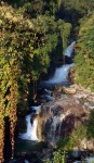
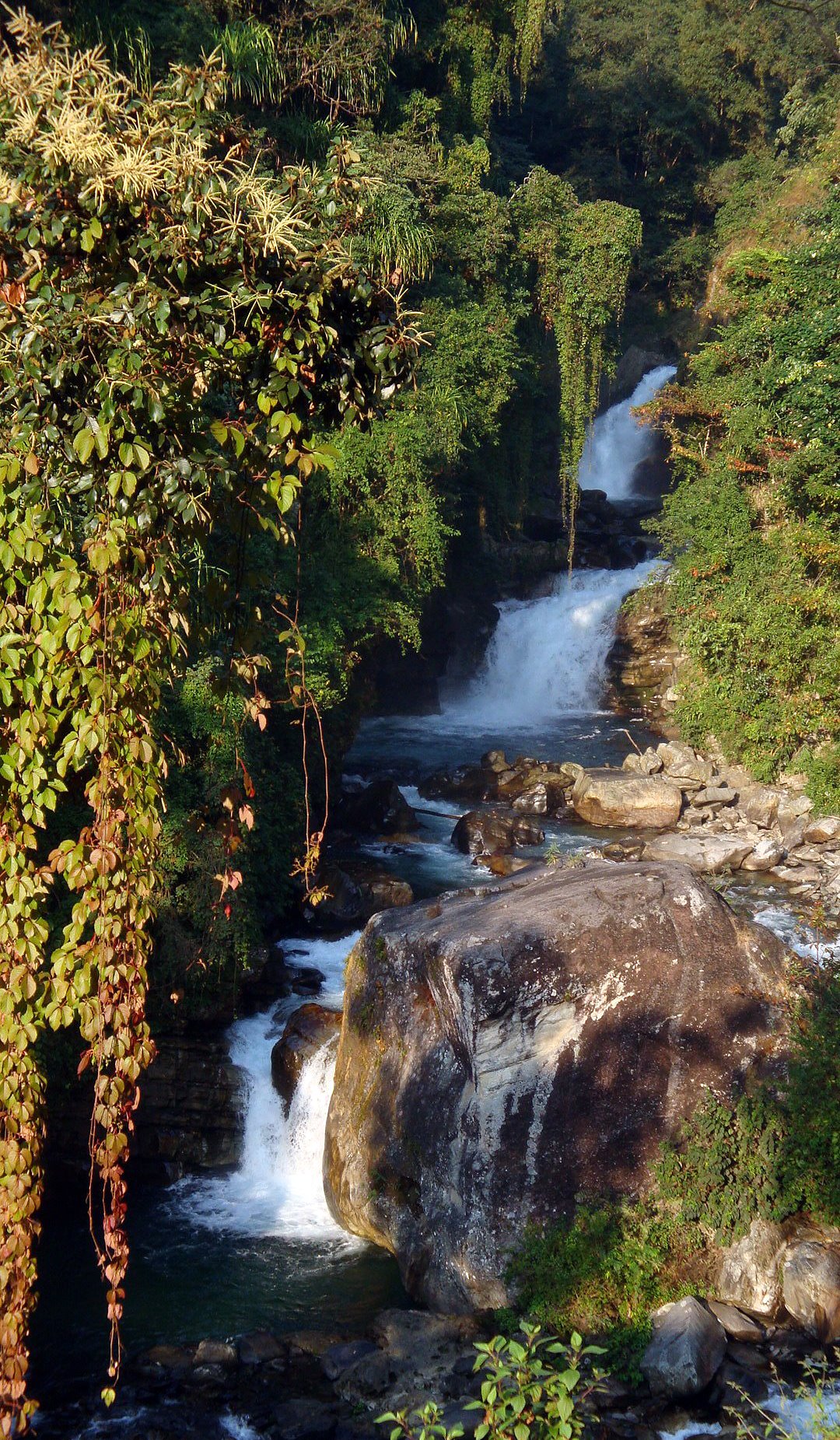
The walk from Dovhan to Himalaya slowly turned sparse into an alpine grassland and was a comparatively easy climb, with beautiful waterfalls along the way. We stopped for a quick tea and made our way to Deurali (about two hours) where we had reserved a room by calling them earlier on the day. We finally reached Deurali around 5 in the evening to find that our room had been given to someone else and we instead scrambled to get a make-shift room carved out of the main dining hall, very noisy and claustrophobic space. And Bijaya would have to sleep in the dining halls. Sad to see that the concept of booking and reservations hasn’t reached this part of the world. (Hint: this is an excellent opportunity for an entrepreneur to figure this reservation system.) We stayed at a lodge called “Shangrila’ and although a bit uncomfortable managed to spend the night some-how. Right besides the room, twenty guides and porters and Bijaya were sleeping in the dining. 🙂
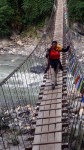
Note: One thing we noticed all along the trek was the make-shift wooden bridges seemed very shabby and poorly made. I was very uncomfortable crossing these bridges. they would particularly hard for an old, untrained trekker. I wish the locals and the Annapurna Conservation Area Project, which charges every foreign tourist 2000 rupees to enter this region, would actually give more thought to making the route better as this is their primary bread-earning mechanism. Can’t always rely on the ‘big brother’ for everything, can we?

Day 6: Deurali 3200m to Maachapuchre base camp -MBC (3700m) to Annapurna base camp ABC (4130m)
Today we would reach the place we had all come to see, the highpoint of the trek. In the morning, my friend Bijaya slipped and hurt his hand while brushing his teeth outside. We realized the icy paths are very dangerous, so do watch out for slippery icy paths in these areas and specially in public bathrooms and peripheries of the hotels here.
Note: As you head out of Deurali, if you look directly on to the other side of the cliff, you will notice a natural shape of Buddha on there. Do ask the locals or your guide about this. Quite a sight!
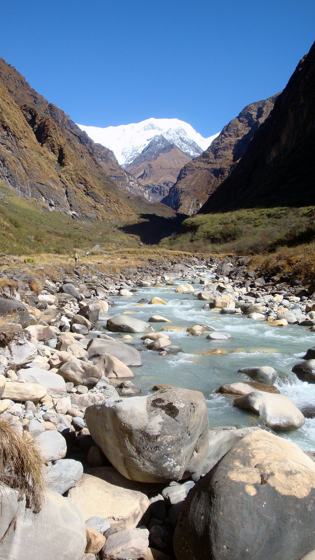
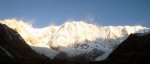
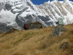
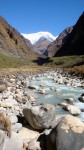
The high altitude slowly began to show on our walks. The air is definitely thinner here as we grew tired faster and faster. We slowly made our way atop the glacial river Modi Khola raging besides us. The path ahead was a gorge between Maachapuchre and Annapurna South. After three and a half hours, at around noon, we reached Maachapuchre base camp (MBC) for lunch. The trek from MBC to ABC is specially stunning as we were surrounded 270 degrees by huge mountains that stared right at your face. It seemed we had entered into a valley of majestic mountains and the gods who lived there.
The path literally trailed besides a huge glacier. It took us two and half hours to reach our final destination. I do stress taking this part of the trek very slowly as to not be over-exert yourself. Exhaustion and rapid gain of heights is the primary cause of high altitude sickness. If you don’t feel well, I recommend stopping at MBC for the night and carry on early in the next morning to ABC.
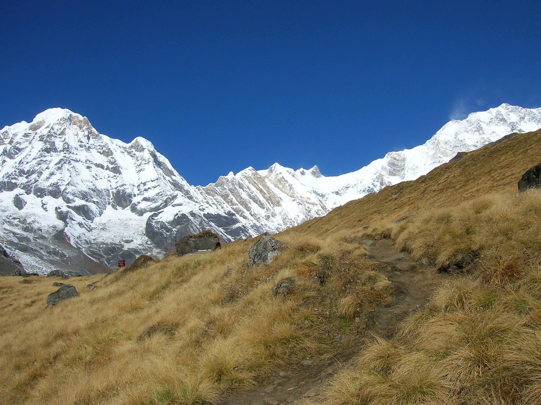
There were 3 lodges at ABC. It was very cold up there, even in middle of October. I recommend carrying a good sleeping bag for a good night’s sleep here. How do I know ? I didn’t bring one and the local blankets were not enough to keep us warm and because of the altitude and cold combo, I didn’t have a good sleep.
Day 7: Annapurna Base Camp (ABC) to Bamboo
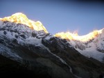
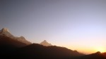
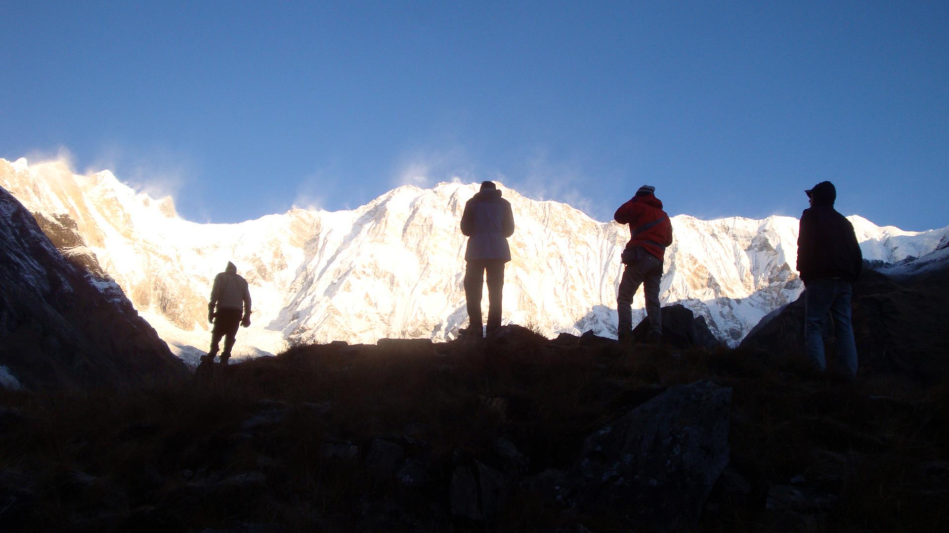
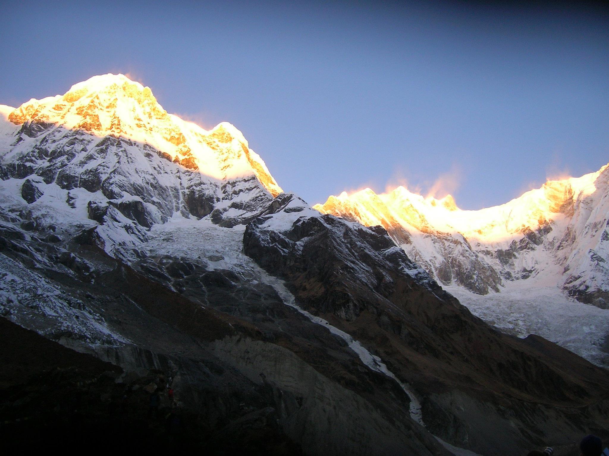
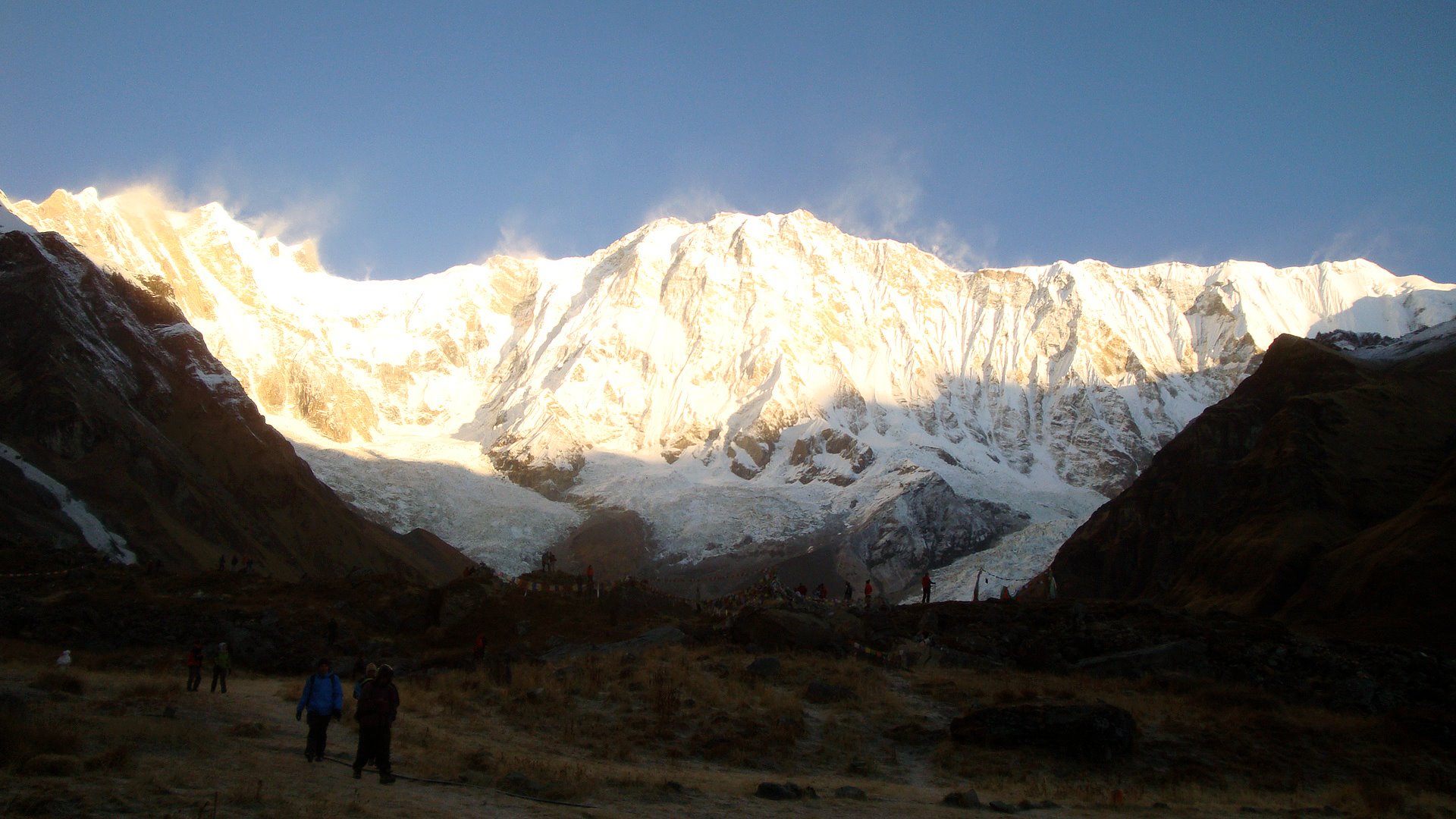
At half past 5 in the dark, we woke up to the sounds of others preparing to watch the sunrise. We slowly made our way to a short 5 minutes walk upto the top of the ridge besides the glacier here, from where we could watch the sun-rise on the mountains all around us. A full moon night would have been perfect to be at ABC. The sight at dawn is hard to describe. These pictures would do justice more than words here.

After the dazzling sunrise theatrics, we came back and had a big breakfast. We decided to head down all the way to Chomrong, while avoiding the bottlenecks at Dovhan and Bamboo if possible. The walk was going to be agonizing long. As we started down this long scenic walk as the sun lit more and more of the sparkling white mountains all around us. Maachapuchre looked majestic from this close.
We were hoping to make it to Dovhan by lunch, but we had seriously over-estimated ourselves as we could only barely make it to Himalaya for lunch. After lunch, we headed further down to Dovhan, doubting if we could make it even to Sinuwa. As we reached Dovhan, it dawned upon us we had to rest either at Dovhan or Bamboo. Not willing to take any chance, we decided to stay at any lodge we found decent enough. Luckily at Bamboo, the traffic that day was low, and we got a room without booking. The night there felt so warm, that I was again back to wearing my shorts. The legs hurt a bit from all the downhill walk but I was hoping the next day’s hot-springs bath would solve that, as we would stop at near there.
It is interesting that you meet folks from all the way from Northern Europe to Africa to South America to Korea on these treks. Here we were the United Nations of travelers marching along a narrow trail much of this trek! One destination, one purpose, perfect !

Day 8: Bamboo 2350m to Sinuwa to Chomrong to Jinuwa 1960m
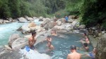
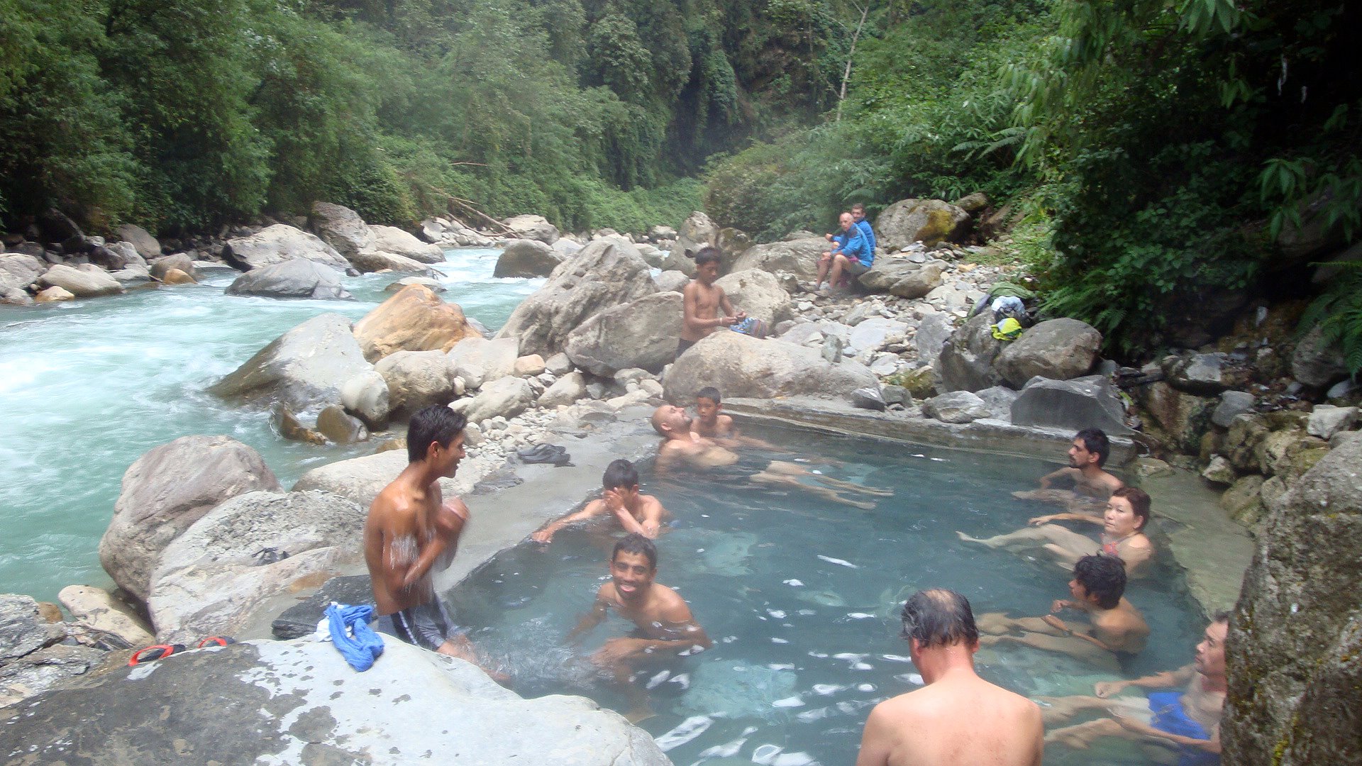
We started from Bamboo, warm and happy. I slept great compared to last night’s freezing temperature at ABC. The walk from Sinuwa to Chomrung was again a painful two hours of up and down stone steps. At Chomrong, we had lunch at a local favorite eatery, Chomrong cottage. I couldn’t resist the blattantly advertised traveler’s favorite, chocolate cake for desert. (the only chocolate desert I saw on the menu on this entire trip). And at about 2, we headed down a steep slope to nearby Jinuwa which was well-known for its hot springs. It took us about one hour steep downhill to get there. As soon as we checked into our local lodge, we took our towels and rushed down to the hot-springs by the river, a half an hour walk down. The hot springs are worth every single bit. We quickly jumped into the warm hot springs, right beside the ice-cold raging Modi khola river. For a complete hour and half, we rested our aching bodies. We knew we had fully rejuvenated our bodies when it actually took us less time to climb up hill than walk down-hill to the hot springs. I will never under-estimate the power of hot springs!
Day 9: Jinuwa to Landruk to Kolte to Deurali to Potana (1900m)
We started our day refreshed. I don’t know if it was the hot springs or the nearing end of our journey. We had now become good climbers, blowing through the torturous looking uphills and downhills with relative ease. We passed Landruk a village on the opposite hill from the popular Ghandruk. A guide we befriended the way, recommended we check out a nice restaurant at Tolke for lunch. (Tourist guides usually are great at recommending the best lodges to stay or eat in). After a delicious Dal-bhat lunch, we started climbing up to Deurali. A pretty tough climb which lasted for an hour.
We stopped for the night at Pothana, a small village by the ridge of a big hill with a good view of Maachhapuchhare. During dinner, a big hailstorm suddenly greeted us. Small chunks of ice were hitting on our tin-roofs which made an hell of a music while we ate. We slept early around eight as had become a habit now. Tomorrow we would be back to the civilization 🙂
Day 10: Pothana (1960m) to Dhampus to Phedi and then bus to Pokhara (850m)
We took a lazy walk from Pothana to Dhampus which already has dirt roads linking it to the main highway. But we decide to trek down to Phedi instead of taking the public transportation.
Phedi is at the foot of Dhampus, every few minutes dancing and singing children were blocking our paths and asking for money as part of Tihar celebration ( a Hindu festival widely celebrated in Nepal). Normally I wouldn’t give money as it encourages begging but in this case there is a special exception as it is for celebrations and only once a year!
From Phedi we took a local bus to Pokhara. As this local bus moved at a snail’s pace picking up every neighbors on the route, we shifted to a taxi midway through, and at 200 Rupees it took us back to beautiful proper Pokhara.
Summary:
- This is a great trek for time starved travelers in Nepal. You can finish the trek in 10 days without rushing, and include sunrise view at Poon hill (which is a little off-route from the usual ABC trail)
- If you are into getting rejuvenated by the raw force of nature, this is definitely the trek to go into. This is not for those seeking outside comfort but rather inside comfort to the soul.
- This is a safe place to travel alone, although if you are a foreigner, we recommend a guide or at least a porter. It helps and you help the local economy.
- This is also a great destination for nature photography enthusiasts and people who just want to wanderlust!
If you have any questions, please feel free to ask me.
around 1000 rupees a day whiling treking (estimate of 1 year ago) .for food and accommodation only.
very subjective on your style of travel… (if you bring porter or guide- charge that extra)
and depends on how you travel to pokhara ….
Every year I come to Nepal for Celebrating Dasai with my family.
It’s indeed an interesting traveling diary and describes well the path to follow and things to be considered while trekking on this route. I was wondering about the expenses because you’ve nowhere mentioned it. Would you mind posting a rough expenses that would incur for this lovely trek? It would be very nice of you.
Glad that you enjoyed it. Hope you make traveling in Nepal, once a year at least. It’s worth it !
Cool…it is one of my to-do in my once in life time dream diary… 🙂 thank u for sharing.